Pyxis Polarization Enhanced Thermal Imagers
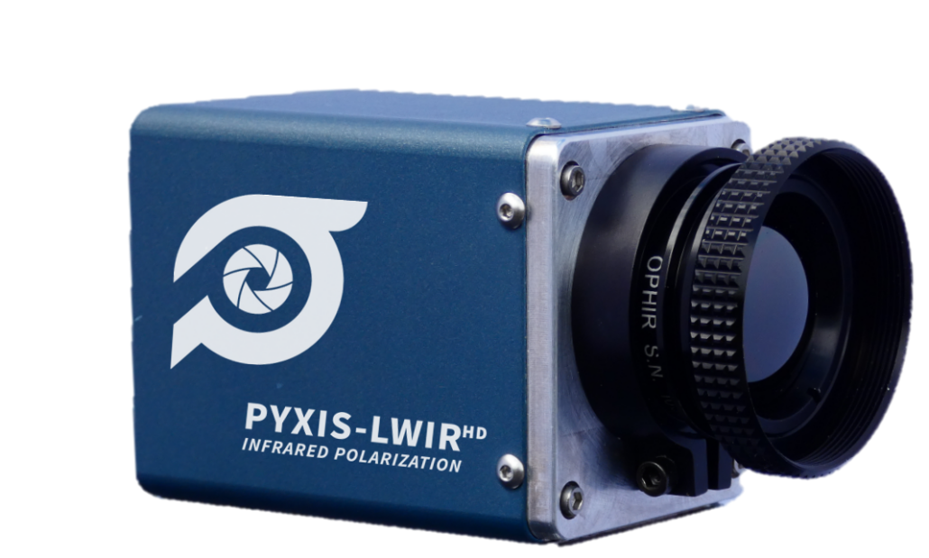
The Pyxis® Series from Polaris Sensor Technologies represents a fundamental advancement beyond conventional thermal imaging — the world’s smallest, lightest polarimetric imagers combining real-time thermal intensity with Degree of Linear Polarization (DoLP) and Angle of Polarization (AoP) in a single, field-deployable camera. Available in LWIR HD, SWIR, and Visible configurations, Pyxis uses a pixelated polarizer array integrated directly onto the focal plane to capture all polarization states simultaneously — eliminating motion artifacts and enabling true snapshot polarimetry. The result is eTherm®, Polaris’s proprietary pixel-level fusion of thermal intensity, polarization orientation, and DoLP into a single intuitive colorized image that reveals material properties, surface geometry, and object structure that standard thermal cameras simply cannot see. Battery-operated, platform-agnostic, and SWaP-optimized for handheld, vehicle-mounted, and UAS integration, Pyxis is a proven force multiplier for ISR, counter-UAS, route clearance, oil-on-water detection, autonomous navigation, and facial recognition applications.
| Why Polarimetric Imaging? The Technology Advantage |
|---|
| Clutter suppression & man-made target detection Man-made objects emit polarized infrared radiation due to their surface geometry and material composition. Natural backgrounds — terrain, vegetation, water — are largely unpolarized. Pyxis exploits this physical difference, making man-made targets stand out even when they are thermally invisible. Targets shaded from the sun that are indistinguishable in a thermal image become clearly visible in the polarization image. |
| Detection through thermal crossover During thermal equilibrium periods — dawn, dusk, nighttime — target temperatures match the surrounding background, making thermal-only detection impossible. Polarization contrast is independent of temperature, allowing Pyxis to continue detecting targets reliably even when conventional LWIR cameras go blind. |
| Detection of partially obscured & under-resolved targets When a vehicle is parked under a tree or a target is partially hidden by foliage, thermal imaging may fail entirely. Polarization signatures can be detected through openings in foliage, and even with just a few pixels on target, the unique polarization signature is sufficient for detection — making size, shape, color, and brightness irrelevant. |
| High True Positive / Low False Positive detection Because polarization is based on the physical properties of the target surface — not thermal contrast or object size — Pyxis achieves high True Positive Detection Rates (TPDR) with low False Positive Detection Rates (FPDR), even in terrain, maritime, and sky clutter environments. |
| eTherm® color fusion — multidimensional situational awareness Polaris’s proprietary eTherm® fuses thermal intensity (brightness), DoLP (saturation), and Angle of Polarization (hue) into a single colorized image. Objects of the same polarization orientation share the same hue — helping operators instantly identify target pose, material composition, and spatial relationships in a single intuitive view. |
| Key Features |
|---|
| • Real-time polarimetric video — simultaneous thermal intensity, DoLP, AoP, and eTherm® color fusion output in a single camera |
| • Snapshot polarimetry — pixelated polarizer array captures all polarization states simultaneously; immune to motion artifacts of sensor or scene |
| • Available in LWIR HD, SWIR, and Visible configurations — each optimized for its waveband and application |
| • Ultra-compact & lightweight — LWIR HD weighs 241 g with lens; VIS body weighs just 65 g; all models SWaP-compatible with handheld, vehicle, and UAS platforms |
| • Up to 400% better contrast than thermal alone — detects oil on water, thermally-invisible targets, and partially-obscured objects that thermal cameras miss |
| • eTherm® color fusion — proprietary pixel-level fusion of thermal, DoLP, and AoP for intuitive colorized situational awareness |
| • Battery-operated & platform-agnostic — handheld, helmet-mounted, vehicle-mounted, or drone-integrated; analog and digital outputs |
| • Polaris Vega & Pyxis Vision Science software — tablet-accessible real-time sensor control, data acquisition, recording, and analysis |
| • 24/7 operation — unaffected by thermal crossover, low light, or nighttime conditions; no illumination required |
System Specifications
Pyxis LWIR HD
| Pyxis LWIR HD — 20 mm f/0.85 Lens | |
|---|---|
| Detector | |
| Detector Type | Uncooled Microbolometer (VOx) |
| Waveband | 7.5 – 13.5 µm (LWIR) |
| Resolution (H × V) | 1024 × 1024 pixels |
| Pixel Pitch | 10 µm |
| Frame Rate | 9 Hz or 30 Hz |
| Field of View (H × V) | 35.5° × 28.7° |
| IFOV | 500 µrad |
| Electrical | |
| Input Voltage | 12VDC or PoE |
| Steady State Power | 6W (12VDC) |
| Mechanical & Environmental | |
| Size with Lens (L × W × H) | 94 × 52 × 48 mm (3.70″ × 2.05″ × 1.89″) |
| Weight with Lens | 241 g (8.5 oz) |
| Operating Temperature | 0°C to +60°C |
Other lenses are available — contact us for more information. Specifications and prices subject to change without notice. This product is only available in the United States.
Pyxis SWIR
| Specification | 16mm f/1.4 | 25mm f/1.4 | 35mm f/1.4 | 50mm f/1.8 |
|---|---|---|---|---|
| Detector | ||||
| Detector Type | InGaAs | |||
| Waveband | 0.6 – 1.7 µm (SWIR) | |||
| Resolution (H × V) | 640 × 512 pixels | |||
| Pixel Pitch | 15 µm | |||
| Frame Rate | Up to 60 Hz | |||
| Optics | ||||
| Field of View (H × V) | 33.4° × 27° | 21.7° × 17.5° | 15.6° × 12.5° | 11° × 8.8° |
| IFOV | 937 µrad | 600 µrad | 429 µrad | 300 µrad |
| Object Distance Range | 0.3m – ∞ | |||
| Electrical | ||||
| Data Interface | GigE | |||
| Input Voltage | 12VDC | |||
| Steady State Power | <8W | |||
| Mechanical & Environmental | ||||
| Size, No Lens (L × W × H) | 107.5 × 50 × 50 mm | |||
| Size with Lens (L × W × H) | 135.7 × 50 × 50 mm | 143.5 × 50 × 50 mm | 145.7 × 50 × 50 mm | 145.7 × 50 × 50 mm |
| Weight, No Lens | 340 g | |||
| Weight with Lens | 400 g | 411.2 g | 427 g | 425 g |
| Operating Temperature | –20°C to +55°C | |||
Specifications and prices subject to change without notice. This product is only available in the United States.
Pyxis VIS
| Specification | 12mm f/1.4 | 16mm f/1.4 | 25mm f/1.4 | 35mm f/1.4 | 50mm f/1.8 | 75mm f/1.8 |
|---|---|---|---|---|---|---|
| Detector | ||||||
| Detector Type | CMOS Mono | |||||
| Waveband | 400 – 900 nm | |||||
| Resolution (H × V) | 2448 × 2048 pixels (5 MP) | |||||
| Pixel Pitch | 3.45 µm | |||||
| Frame Rate | Up to 30 Hz | |||||
| Optics | ||||||
| Field of View (H × V) | 38.8° × 32.8° | 29.6° × 25.0° | 19.2° × 16.1° | 13.8° × 11.5° | 9.7° × 8.1° | 6.4° × 5.4° |
| IFOV | 287 µrad | 216 µrad | 138 µrad | 99 µrad | 69 µrad | 46 µrad |
| Object Distance Range | 0.1m – ∞ | 0.2m – ∞ | 0.3m – ∞ | 0.4m – ∞ | 0.5m – ∞ | 0.6m – ∞ |
| Electrical | ||||||
| Data Interface | USB 3.0 | |||||
| Input Voltage | 5VDC | |||||
| Steady State Power | 4W | |||||
| Mechanical & Environmental | ||||||
| Size, No Lens (L × W × H) | 43 × 29 × 29 mm | |||||
| Size with Lens (L × W × H) | 82.2 × 35 × 35 mm | 85.4 × 35 × 35 mm | 81.4 × 35 × 35 mm | 82.2 × 35 × 35 mm | 108.7 × 35 × 35 mm | 115.2 × 36 × 36 mm |
| Weight, No Lens | 65 g | |||||
| Weight with Lens | 165 g | 173 g | 151 g | 149 g | 178 g | 211 g |
| Operating Temperature | –5°C to +45°C | |||||
Specifications and prices subject to change without notice. This product is only available in the United States.
| Applications |
|---|
| • Intelligence, Surveillance & Reconnaissance (ISR) — day/night target detection in terrain, sky, and maritime clutter environments |
| • Counter-UAS (C-UAS) — polarization-enhanced contrast for detection, discrimination, and tracking of UAS threats |
| • Route clearance — detection of IEDs, mines, and other buried or hidden threats in high-clutter environments |
| • Oil-on-water detection — detects oil as thin as 50 µm, distinguishing it from vegetation, sea kelp, and sun glint up to 1 km away |
| • Autonomous navigation — road edge detection, visual odometry, vehicle following, and autonomous landing zone safety for UAS |
| • Facial recognition & biometric ID — polarization-enhanced thermal imagery for non-cooperative biometric identification without external illumination |
